May 2, 2013
Lordsburg to Collins Park
As we have traveled north from the lower Chihuahuan desert the terrain has become more varied. We have hiked through high desert, to paved road walking to connect unfinished parts of the trail, up through a Ponderosa pine forest to Signal Peak Fire Lookout at about 9,000 ft, through rolling hills of golden grasses that remind us of Central CA, to the unique part of this section - spending 3+ days walking the trail along the Gila River and the Middle Fork of the Gila River near the Gila Cliff Dwellings National Monument (GCDNM).
Weather: The weather continues to be pleasant for hiking - from the 70's to the 80's during the day and dry. A breeze magically seems to appear during the afternoon to cool us off. Surprisingly, the nights can be cold. A few nights it dipped below freezing and Mike discovered that his sleeping bag isn't cutting the mustard. He is going to pick up a warmer bag at REI in Albuquerque as we move closer to that area.
Impressions:
* We have enjoyed the changes in terrain that this section has offered.
* We appreciated Brother James guiding us back to the CDNST when we accidentally took a spur trail onto the Our Lady of Guadalupe Benedictine Monastery near Silver City.
* I was surprised how few people we saw in GCDNM. Because no one else was there, the rangers led us on a private tour of the Gila cliff dwellings (caves inhabited by Mogollon people around 1280 a.d.). Traveling off-season is the only way to go!
* The trail along the Gila River required us to walk through the river over 200 times! When the sun rose above the canyon walls, around 10 a.m., the water was a cool relief to warm, blistered feet. During the early morning we were bundled up in our down jackets and rain parkas and our feet felt like numb stumps.
* Other than along the river, water continues to be a real concern for the through-hikers. Mike has been named Waterman by one of them because he leaves water jugs outside of our trucks when we park. They appreciate his caches vs. the icky-looking colored water they retrieve from the cattle tanks!
* Mike and I didn't realize how dirty you can get from a week of backpacking in this dry terrain. Even after we showered we were still dirty!
* We continue to see through-hikers but less and less as we all spread out along the trail.
* I am amazed how the outside world has faded away and how all of my thoughts are focused on this activity - I rarely think of the job I left behind, our home in Denver, whether our bills are being paid, if our dog is okay, etc. I think about our route for the next few hours, or maybe for that day and the next. Thoughts range from: "Wow, this is pretty!", "Do I need to put on more sunscreen?", "Was that a javelina (a wild boar) that just ran by?", "Are we drinking enough water?", "Did we really have another river crossing?", "Do I have anymore gorp?", "Should we stay at the privately-owned rustic campground near GCDNM and soak in the hot springs?" We start out each day with a rough plan and then it develops throughout the day.
Our condition: We are both feeling physically strong but blisters continue to be a problem for me. Some blisters have become calluses but unfortunately, some new ones have appeared. I can't say enough good things about about Leukotape - it (along with Ibuprofen) is allowing me to press on!
Coming up: The next section will move us towards the small town of Grants. We anticipate this taking a few weeks of backpacking so no new postings will appear in the near future. We are hoping to log more miles per day through this section.
Total Miles to Date: 270
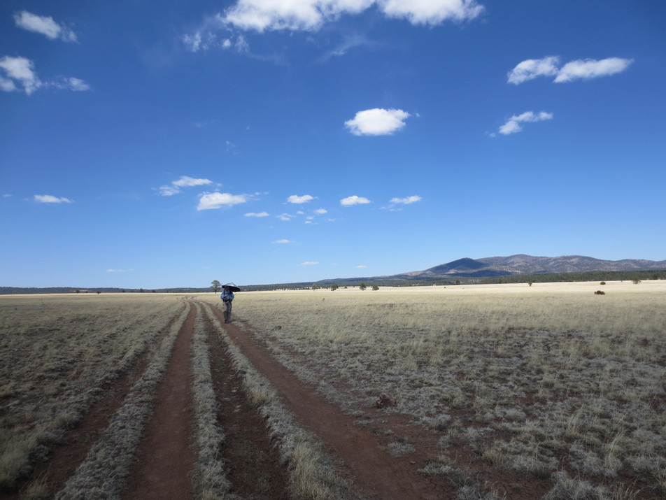
On dirt track from Collins Park to Snow Lake. Mike testing out his umbrella for shade.
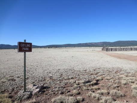
Collins Park - this sign and an old corral. That's it!
|
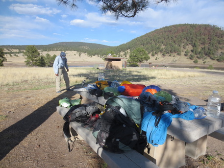
Snow Lake - no snow, a shrinking reservoir instead of a lake, but that's okay because there are no people! We shared the entire campground with one other through-hiker named Papa Smurf.
|
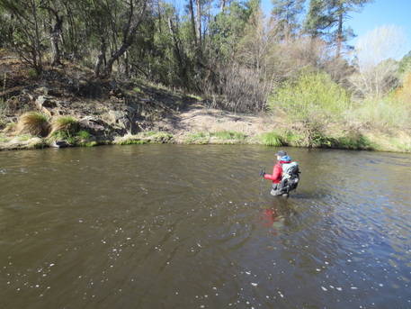
Let's see.... was this river crossing #145 or #153 - I can't remember!
|
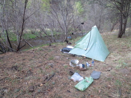
Our campsite halfway through the Middle Fork of the Gila River. We only met two outfitters and their 3 horses the entire day.
|
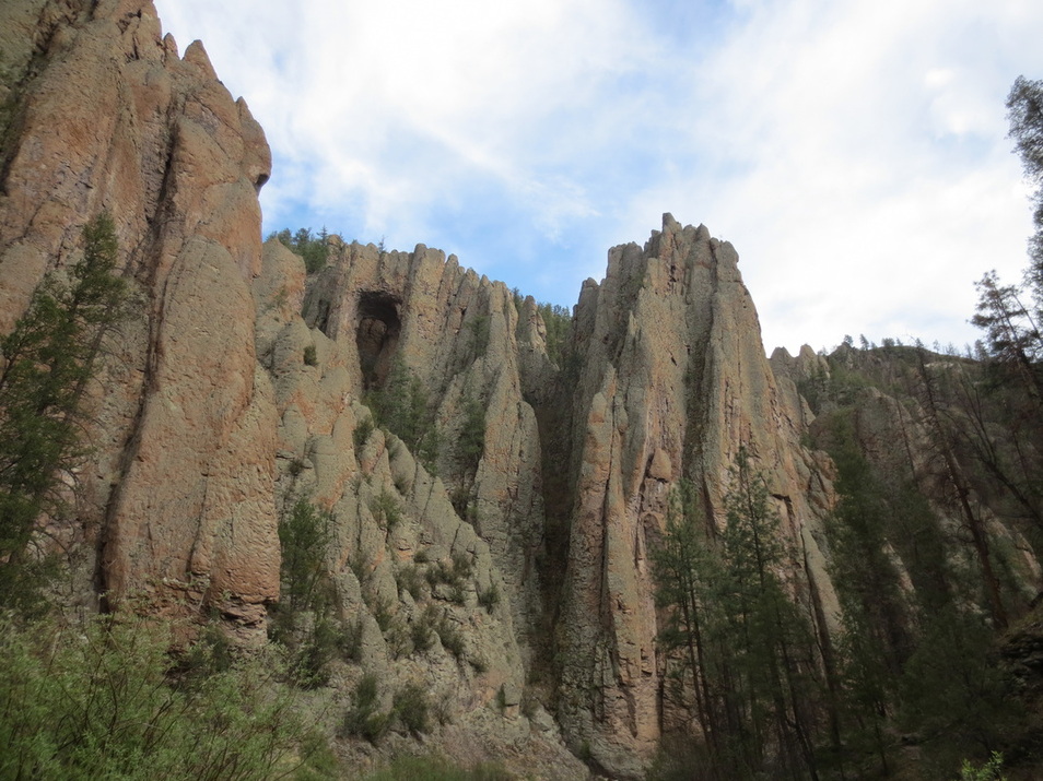
Although you want to look down when you are crossing the slick river rock and sometimes strong currents, the spectacular views are above!

Really?! Just outside the GCDNM Visitor's Center.
|
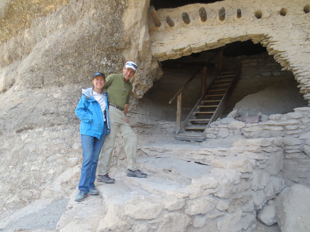
Day off to play tourist and visit the cliff dwellings.
|
