July 14, 2013
Wyoming- Done!
On July 12 we completed hiking the CDNST through WY - Woo Hoo!
Miles Hiked in WY: 520
We have hiked the rest of the trail as it headed northwest through Wyoming - from South Pass City through Yellowstone National Park!
Impressions:
Wind River Range:
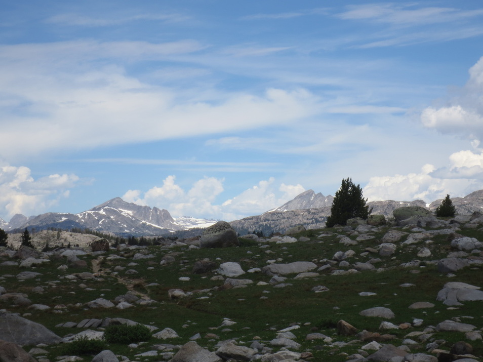
*As we headed out of the high desert from South Pass City into the Wind River Range the terrain changed dramatically. The trail through the Winds is thickly forested at lower elevations, and above tree line is surrounded by cirques of granite peaks.
*At higher elevations snowfields still remained, which at times made finding or hiking the trail challenging. In areas where the snow had or was melting, the trails became streams.
*No matter what elevation the range is full of water - lakes (so many that the smaller lakes are not named), rivers, creeks, streams and every other word you can think of for water. When we first entered the Winds we thought that we should look for log crossings to get across the water. Wrong! We quickly realized that we needed to walk through the water. I found a few of the swiftly running water crossings to be quite scary.
*With an abundance of water comes an abundance of mosquitoes! They made us crazy as we backpacked through this area! Our first stop when we left the mountains (I do mean "first" - 7 a.m. on a Sunday morning) was at an outfitters' store to stock up on mosquito protection - we both bought bug repellant shirts, 100% Deet spray to apply to our skin and spray for our clothes/ gear. We already had nets you pull over your head - thank goodness!
Brooks Lake: A four day backpack from the south end of Yellowstone National Park (YNP) ended here. It is a beautiful lake that was surrounded by wildflowers and peaks called the Pinnacles. Picture postcard beautiful! We saw two young grizzly bears in this area - luckily from a distance!
Yellowstone National Park:
*Because of the major fire in 1988, the forested areas are a combination of old growth lodge pole pine forest or younger lodge poles that make you feel like you are walking through a tree farm.
*Active geysers and thermal activity produce colorful pools and streams. One geyser erupted just as we were walking by - how timely!
*Large lakes. Listening to the waves lapping near the shoreline trail at Shoshone Lake made me feel as if I were walking around an ocean island. Very pleasant!
* Lots of tourists at the major destinations like Old Faithful Geyser and Inn. Hardly anyone on the trails when you move about a mile from the road.
* Many rules. To sleep overnight in the backcountry you have to obtain a permit and sleep at a designated spot on a specific night. Very annoying. Backpacking into YNP from the west we slept within feet of the park entrance to avoid the bureaucracy. Not that anyone would have noticed - hardly anyone walks in this way because you cannot drive to this entrance and it is over 16 miles to the main road that runs through the park.
Other Hikers: We only met one group of 3 CDNST hikers in the entire state of WY. As we were beginning to hike in MT or ID (it is hard to tell what state you are in on this part of the trail because the trail zigzags along the state boundaries) we met Jim and Fred. They are 74 years young and have known each other since high school. They hike a section of the CDNST each summer. This summer they are hiking a 269 mile segment from Heart Lake in YNP to Bannock Pass in MT. Their picture is posted on the Other Hikers page.
Condition: Mike and I have no injuries or blisters. We feel physically strong. We are trail hardy but travel weary. We started hiking in NM on April 14 so we have been at this for 3 months now. We are taking a zero (logging no hiking miles today) and are staying in a motel in West Yellowstone.
Coming up: We are debating between heading south to complete a 160 mile stretch we need to complete CO or continuing west as the trail zigzags back and forth through ID and MT.
Impressions:
Wind River Range:
*As we headed out of the high desert from South Pass City into the Wind River Range the terrain changed dramatically. The trail through the Winds is thickly forested at lower elevations, and above tree line is surrounded by cirques of granite peaks.
*At higher elevations snowfields still remained, which at times made finding or hiking the trail challenging. In areas where the snow had or was melting, the trails became streams.
*No matter what elevation the range is full of water - lakes (so many that the smaller lakes are not named), rivers, creeks, streams and every other word you can think of for water. When we first entered the Winds we thought that we should look for log crossings to get across the water. Wrong! We quickly realized that we needed to walk through the water. I found a few of the swiftly running water crossings to be quite scary.
*With an abundance of water comes an abundance of mosquitoes! They made us crazy as we backpacked through this area! Our first stop when we left the mountains (I do mean "first" - 7 a.m. on a Sunday morning) was at an outfitters' store to stock up on mosquito protection - we both bought bug repellant shirts, 100% Deet spray to apply to our skin and spray for our clothes/ gear. We already had nets you pull over your head - thank goodness!
Brooks Lake: A four day backpack from the south end of Yellowstone National Park (YNP) ended here. It is a beautiful lake that was surrounded by wildflowers and peaks called the Pinnacles. Picture postcard beautiful! We saw two young grizzly bears in this area - luckily from a distance!
Yellowstone National Park:
*Because of the major fire in 1988, the forested areas are a combination of old growth lodge pole pine forest or younger lodge poles that make you feel like you are walking through a tree farm.
*Active geysers and thermal activity produce colorful pools and streams. One geyser erupted just as we were walking by - how timely!
*Large lakes. Listening to the waves lapping near the shoreline trail at Shoshone Lake made me feel as if I were walking around an ocean island. Very pleasant!
* Lots of tourists at the major destinations like Old Faithful Geyser and Inn. Hardly anyone on the trails when you move about a mile from the road.
* Many rules. To sleep overnight in the backcountry you have to obtain a permit and sleep at a designated spot on a specific night. Very annoying. Backpacking into YNP from the west we slept within feet of the park entrance to avoid the bureaucracy. Not that anyone would have noticed - hardly anyone walks in this way because you cannot drive to this entrance and it is over 16 miles to the main road that runs through the park.
Other Hikers: We only met one group of 3 CDNST hikers in the entire state of WY. As we were beginning to hike in MT or ID (it is hard to tell what state you are in on this part of the trail because the trail zigzags along the state boundaries) we met Jim and Fred. They are 74 years young and have known each other since high school. They hike a section of the CDNST each summer. This summer they are hiking a 269 mile segment from Heart Lake in YNP to Bannock Pass in MT. Their picture is posted on the Other Hikers page.
Condition: Mike and I have no injuries or blisters. We feel physically strong. We are trail hardy but travel weary. We started hiking in NM on April 14 so we have been at this for 3 months now. We are taking a zero (logging no hiking miles today) and are staying in a motel in West Yellowstone.
Coming up: We are debating between heading south to complete a 160 mile stretch we need to complete CO or continuing west as the trail zigzags back and forth through ID and MT.

Hiking into the Wind River Range from Green River Lakes Trailhead near the northwest end of the range
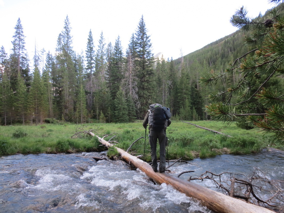
Mike doing an amazing balancing act as he crosses a river in the Winds
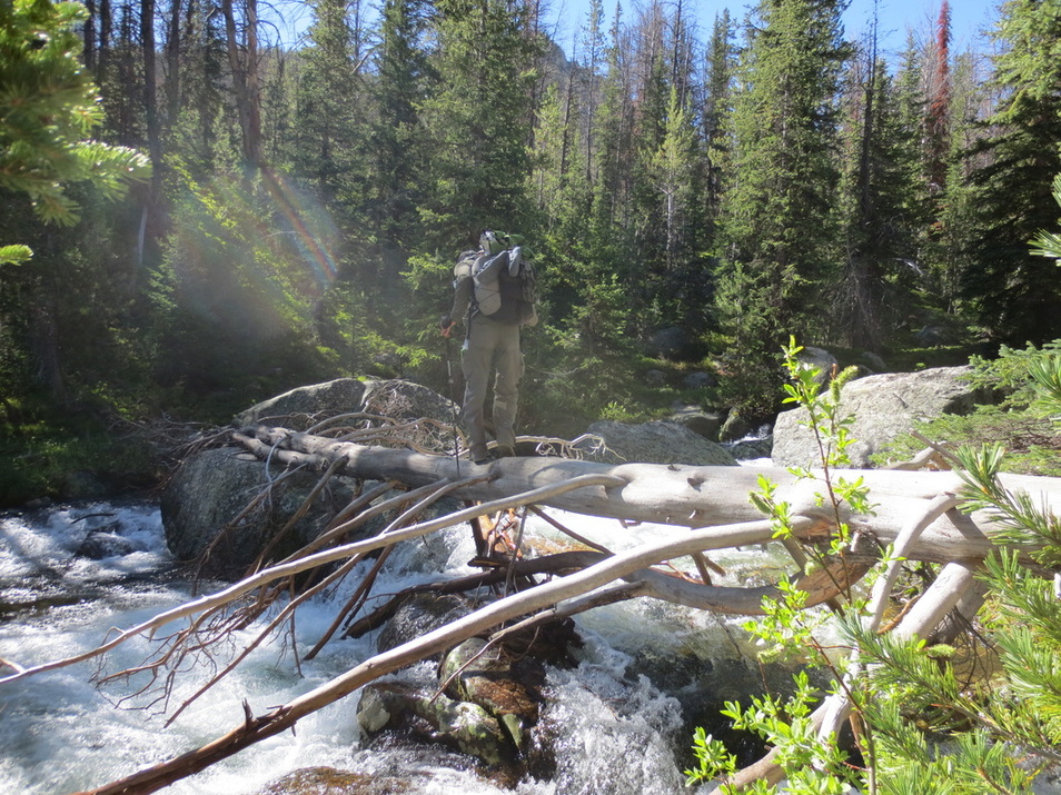
And another balancing act!

Mellow crossing between lakes
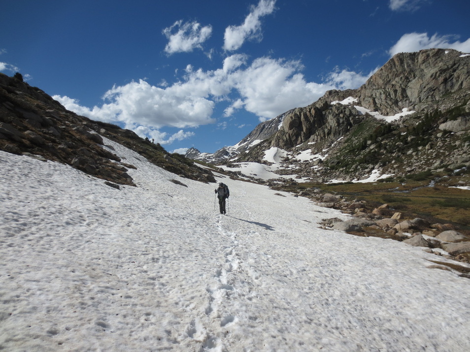
One of many snowfield crossings in the Winds
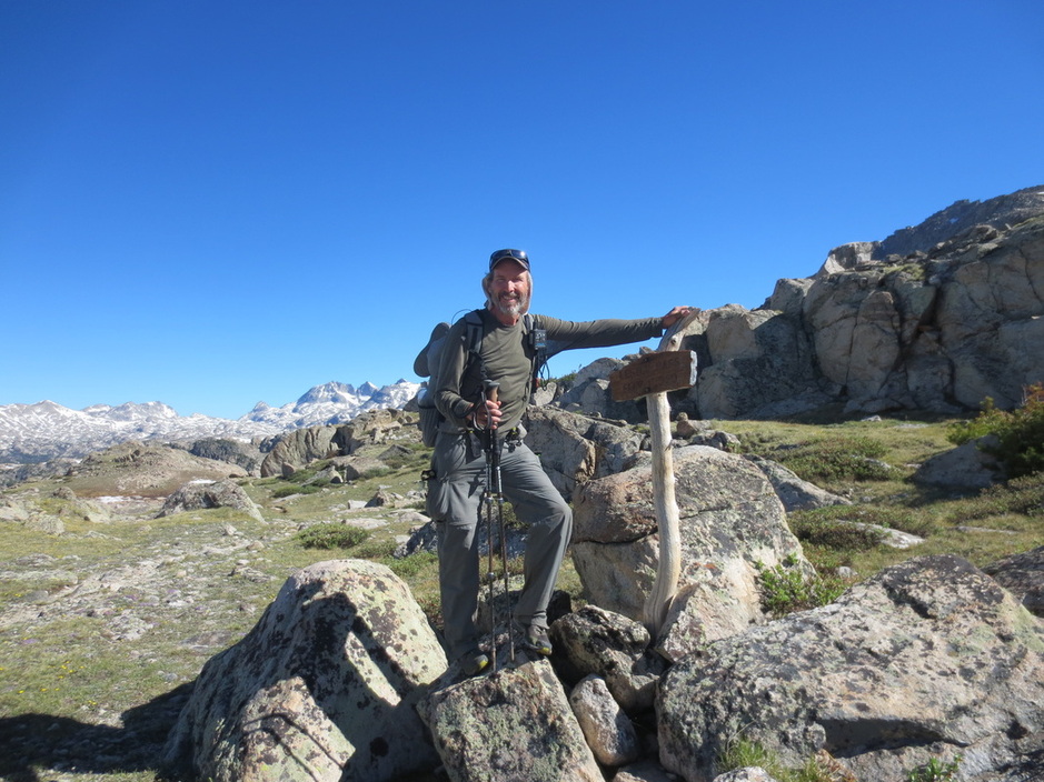
Lester Pass - over 11,000 feet. This is highest point on CDNST in WY. Mosquitoes were even at this elevation in the Winds!
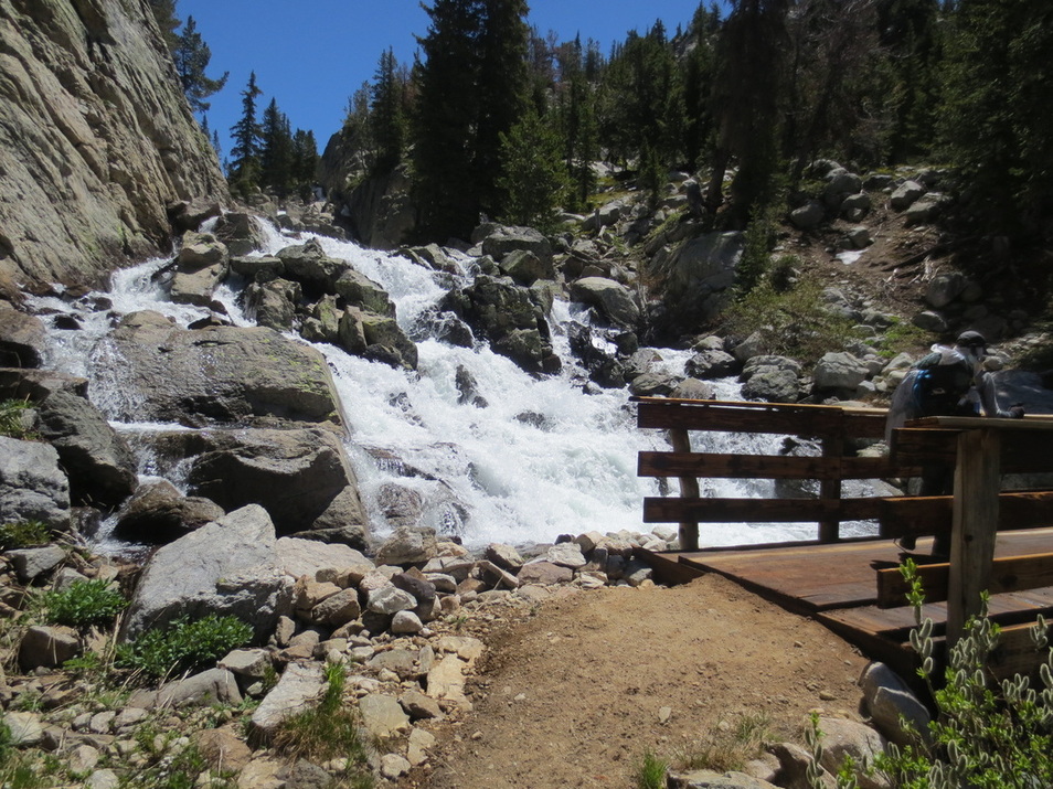
Yea - a bridge!
The trail pulled away from the mountains as we headed southeast out of the Winds towards Big Sandy Trailhead
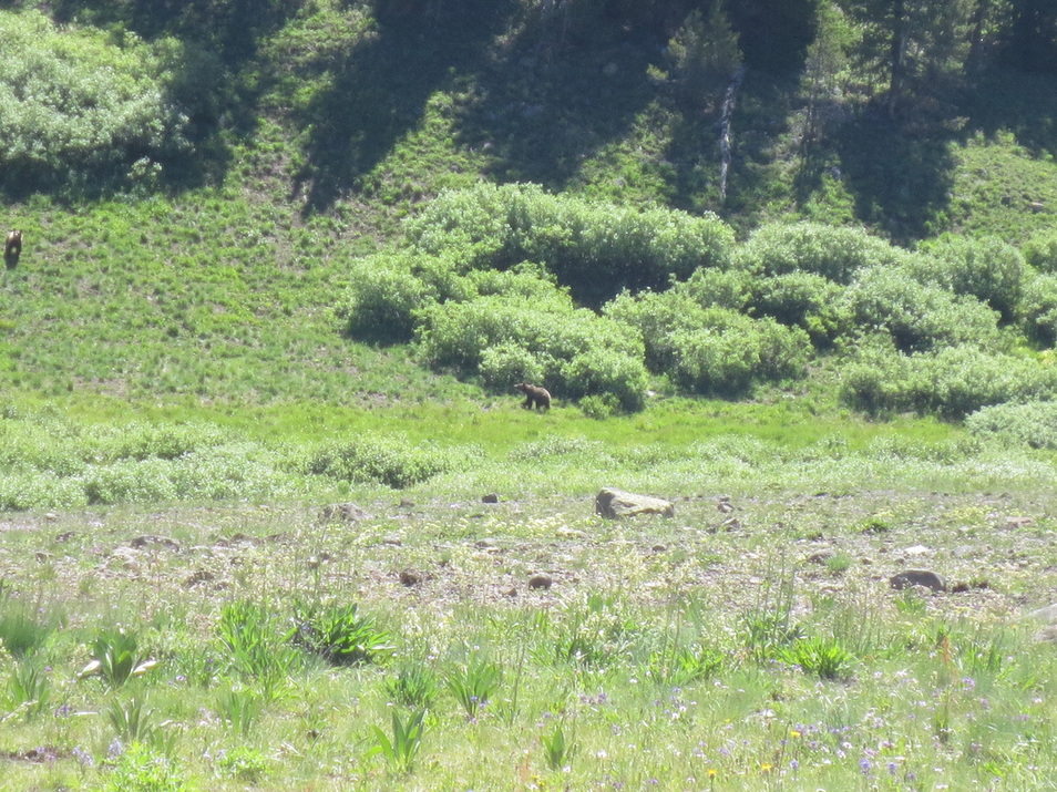
Two young grizzly bears just north of Brooks Lake. Brooks Lake is about 80 miles southeast of Yellowstone National Park (YNP).
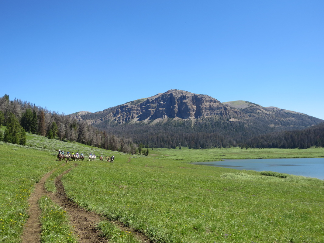
Outfitter leading riders from the mountains around Brooks Lake
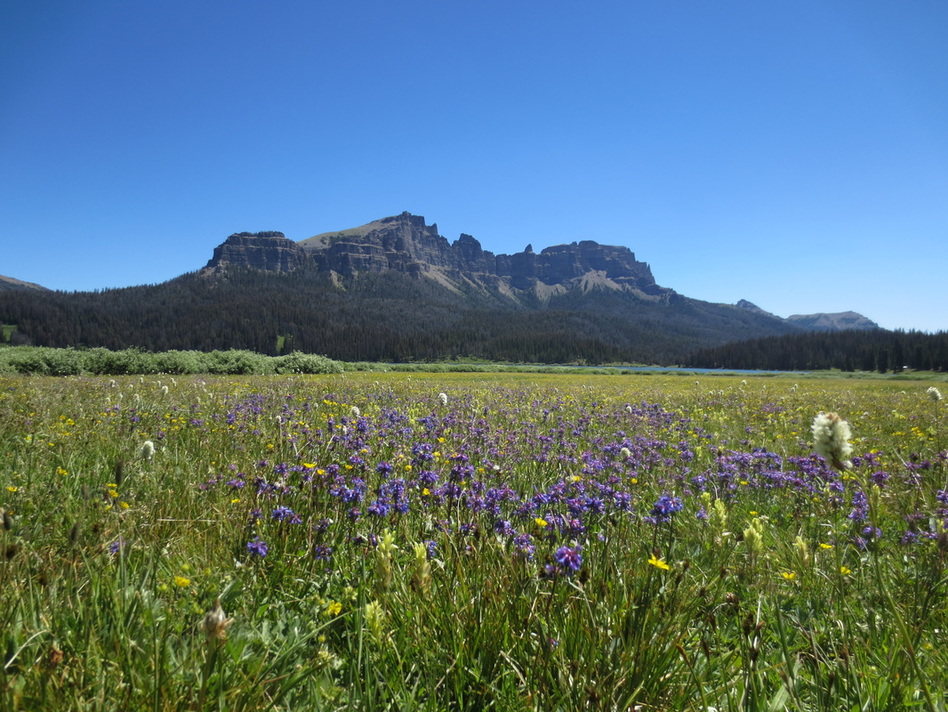
Part of the Pinnacles near Brooks Lake
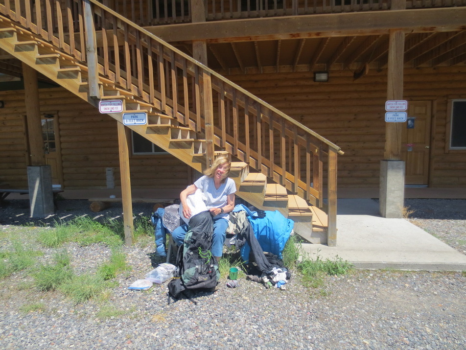
Getting ready to do laundry at the Lava Lodge after backpack from YNP to Brooks Lake
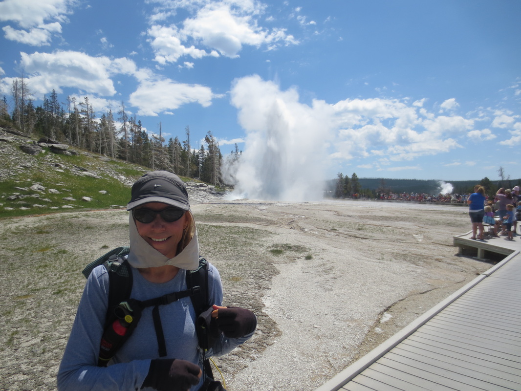
We happened upon a geyser erupting as we were walking by - how perfect! The CDNST follows the boardwalk for about a mile around the Old Faithful area of YNP.
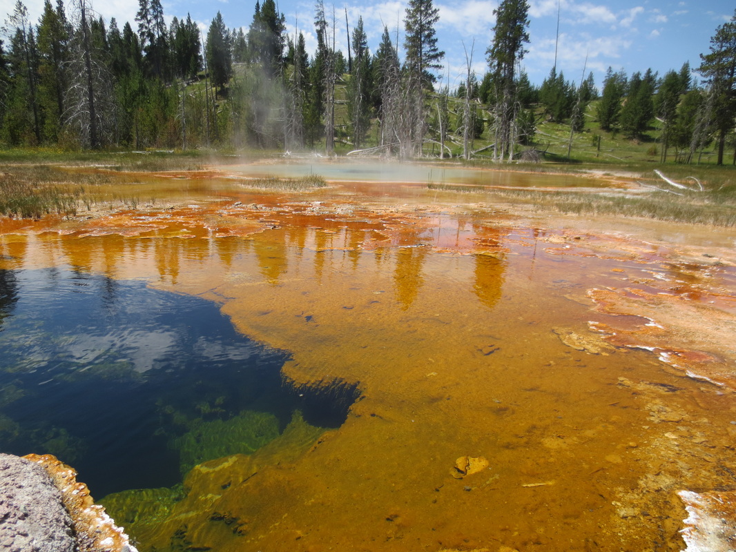
Colorful water from thermal activity
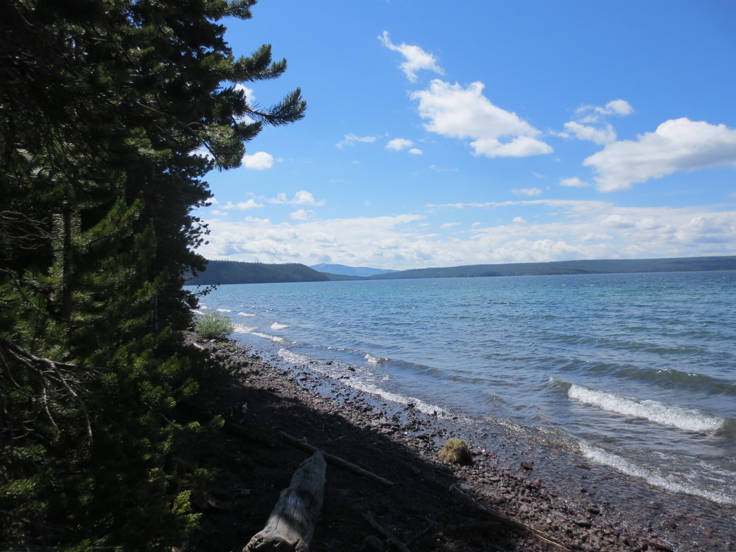
Shoshone Lake in YNP

Nose to nose in full campground at Grants in YNP. We discovered that sleeping in our car next to other RV'ers is perfect because when the sun goes down they go into their RV's. It makes for a very nice and quiet campground!

Common metal signage on trails around the YNP. Our destination on this day was about 17 miles - just short of Old Faithful.
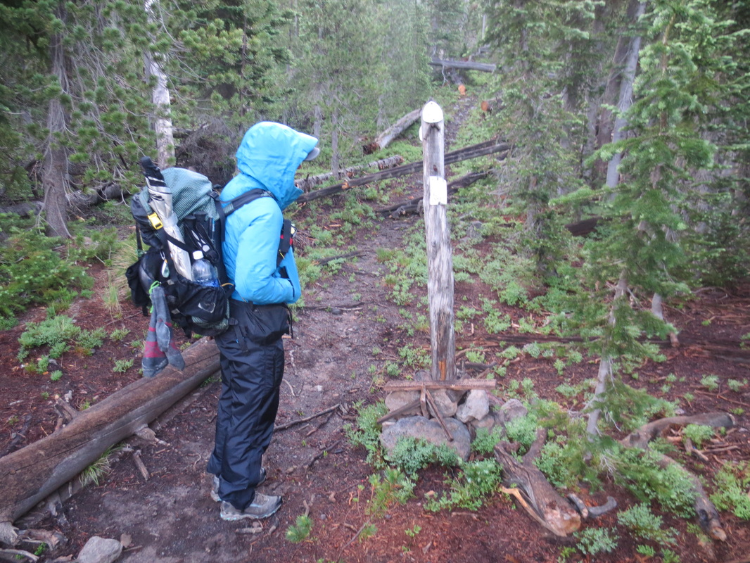
No metal sign here! The park has chosen not to clear the trail or replace beat up old signs on this west entrance to the park that no one uses - that is, except CDNST hikers. Not very welcoming!
