July 27, 2013
Colorado - Done!
On July 26 we completed the CDNST through CO - Woo Hoo!
Miles Hiked in CO This Year: 148
Total Miles Hiked in CO: 759
We decided to leave MT and head back to Southern CO to complete the 150 mile stretch we needed in the San Juan Mountains. We wanted to have NM, CO
and WY under our belt before we tackled MT/ID in earnest. Because of the wildfires that devastated over 100,000 acres in this area just a few weeks ago not all of the CDNST was reopened, so we road walked this section. Instead of expansive vistas from above, we enjoyed views of the mountains by walking
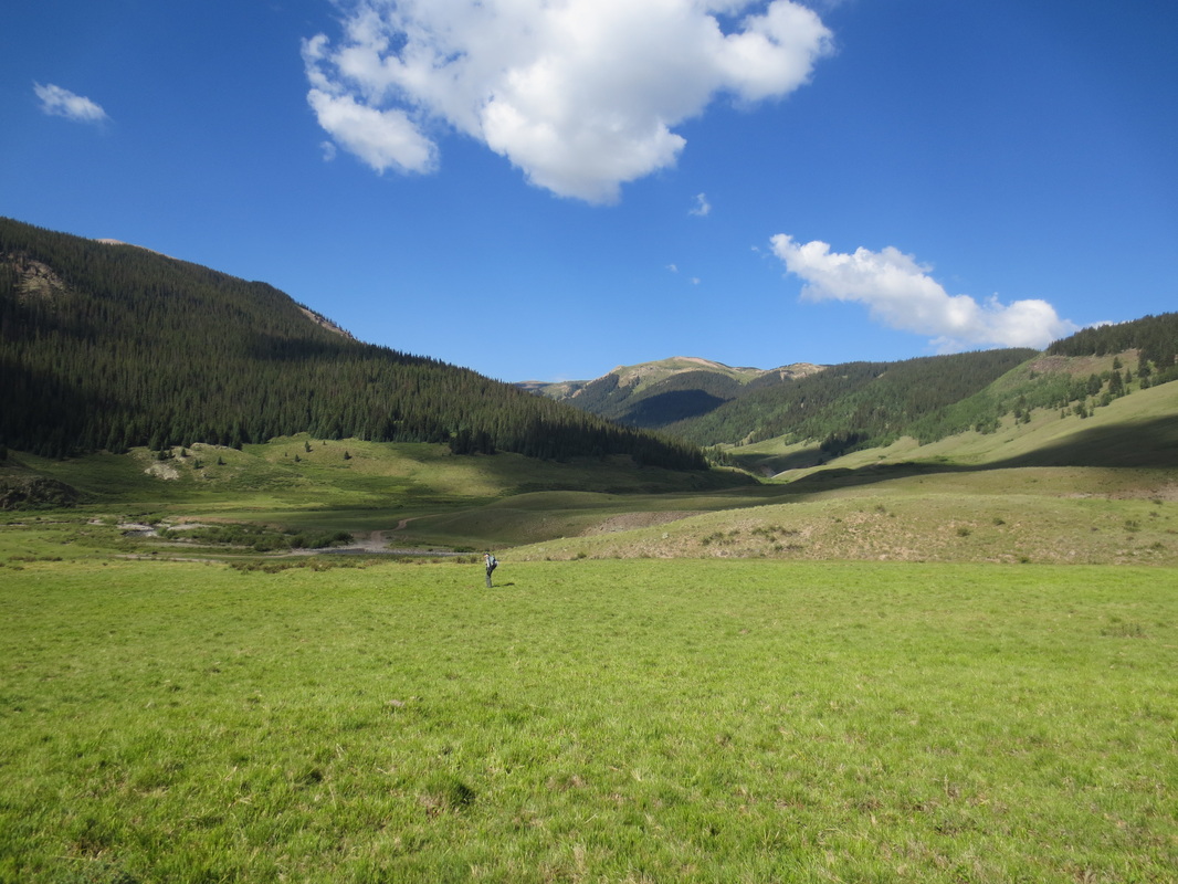
through wide and deep valleys - often alongside meandering rivers, fishing and bird habitat reservoirs or meadows sprinkled with wildflowers or......of course.....cows!
Weather: Another part of the decision to do this entire section as a road walk was the weather. The first day we headed out a heavy lightening and thunder storm rolled in at 12:30 p.m. Normally, these occur later in the day. The challenge hiking the trail in CO is that when the lightening and thunder rolls in you need to get off of the highest points (essentially the entire trail). Coming down off of the highest points into the burn areas could have made us vulnerable
to flash flooding because of the lack of ground cover.
Impressions:
* I had forgotten how much I enjoy this part of CO. It is so beautiful! We are not the only ones that know this. Even just a few weeks after the fires, we
encountered lots of people fishing on the Conejos and Rio Grande Rivers, riding all terrain vehicles and jeeps on the maze of dirt roads and camping in their RV's either at primitive or for-a-fee sites. It didn't feel crowded, but somehow comfortable seeing others appreciate the area.
* It is unfortunate that so much of this area was burned, but it was interesting to see the effects of the fire.
* It was fun meeting Maverick, another CDNST hiker, near Elwood Pass. He is a teacher in AZ and is spending his summer vacation hiking from Mexico to Rawlins, WY.
* We enjoyed meeting and talking with Nathan and John who were riding their mountain bikes on the Great Divide Mountain Bike Route that
extends from Banff, Alberta, Canada to Mexico. They said that had ridden through some crazy rain and hail storms during the previous few
days.
* Trail magic does exist! To complete the last 12 miles of our hike was going to mean we would have to walk 24 miles because we were uncomfortable taking either of our 200,000+ mile SUV's on this gnarly 4WD dirt road. But Steve and Judy Johnson came to our rescue with their 4WD Toyota truck. Steve, the Zen master of 4 wheel driving, expertly taxied us back to our cars all the while telling us about great outdoor adventures he and Judy have shared. As Judy so aptly put it, "most people don't get out of their own zip code". See pictures of everyone on the Other Travelers page.
Condition:
Mike and I have no injuries or blisters. We feel fortunate that neither of us has contracted any illnesses on this trip. Fingers crossed that this continues!
Coming up:
After a couple of days of rest and resupplying we will head back to hike through MT/ID.
Miles Hiked in CO This Year: 148
Total Miles Hiked in CO: 759
We decided to leave MT and head back to Southern CO to complete the 150 mile stretch we needed in the San Juan Mountains. We wanted to have NM, CO
and WY under our belt before we tackled MT/ID in earnest. Because of the wildfires that devastated over 100,000 acres in this area just a few weeks ago not all of the CDNST was reopened, so we road walked this section. Instead of expansive vistas from above, we enjoyed views of the mountains by walking
through wide and deep valleys - often alongside meandering rivers, fishing and bird habitat reservoirs or meadows sprinkled with wildflowers or......of course.....cows!
Weather: Another part of the decision to do this entire section as a road walk was the weather. The first day we headed out a heavy lightening and thunder storm rolled in at 12:30 p.m. Normally, these occur later in the day. The challenge hiking the trail in CO is that when the lightening and thunder rolls in you need to get off of the highest points (essentially the entire trail). Coming down off of the highest points into the burn areas could have made us vulnerable
to flash flooding because of the lack of ground cover.
Impressions:
* I had forgotten how much I enjoy this part of CO. It is so beautiful! We are not the only ones that know this. Even just a few weeks after the fires, we
encountered lots of people fishing on the Conejos and Rio Grande Rivers, riding all terrain vehicles and jeeps on the maze of dirt roads and camping in their RV's either at primitive or for-a-fee sites. It didn't feel crowded, but somehow comfortable seeing others appreciate the area.
* It is unfortunate that so much of this area was burned, but it was interesting to see the effects of the fire.
* It was fun meeting Maverick, another CDNST hiker, near Elwood Pass. He is a teacher in AZ and is spending his summer vacation hiking from Mexico to Rawlins, WY.
* We enjoyed meeting and talking with Nathan and John who were riding their mountain bikes on the Great Divide Mountain Bike Route that
extends from Banff, Alberta, Canada to Mexico. They said that had ridden through some crazy rain and hail storms during the previous few
days.
* Trail magic does exist! To complete the last 12 miles of our hike was going to mean we would have to walk 24 miles because we were uncomfortable taking either of our 200,000+ mile SUV's on this gnarly 4WD dirt road. But Steve and Judy Johnson came to our rescue with their 4WD Toyota truck. Steve, the Zen master of 4 wheel driving, expertly taxied us back to our cars all the while telling us about great outdoor adventures he and Judy have shared. As Judy so aptly put it, "most people don't get out of their own zip code". See pictures of everyone on the Other Travelers page.
Condition:
Mike and I have no injuries or blisters. We feel fortunate that neither of us has contracted any illnesses on this trip. Fingers crossed that this continues!
Coming up:
After a couple of days of rest and resupplying we will head back to hike through MT/ID.
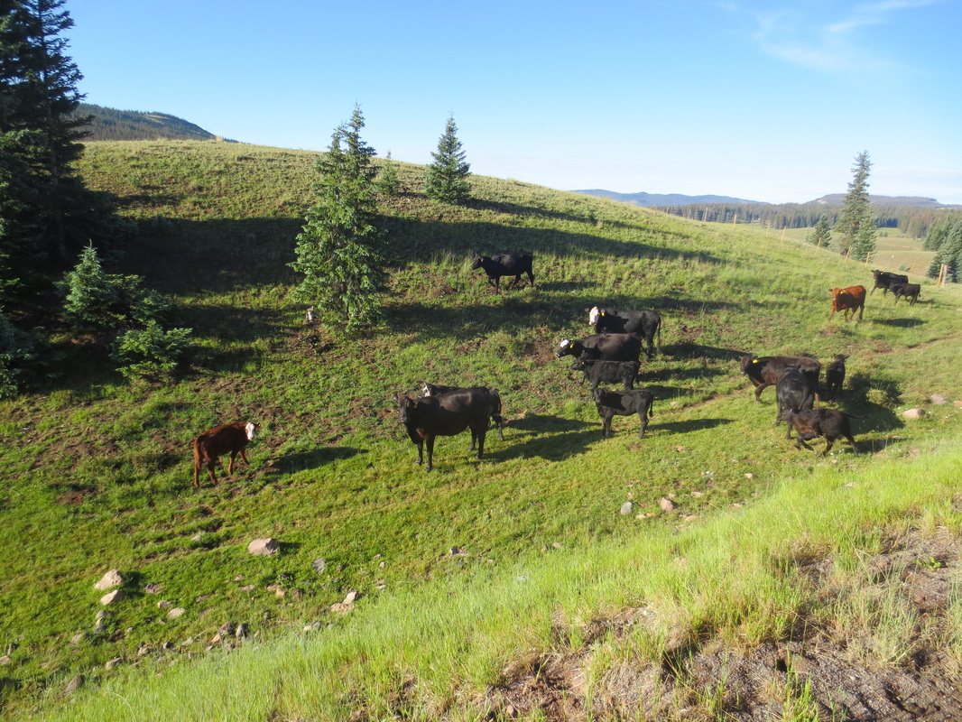
I feel a bit off when we don't see cows during the day. All was well in my hiking world on this day!
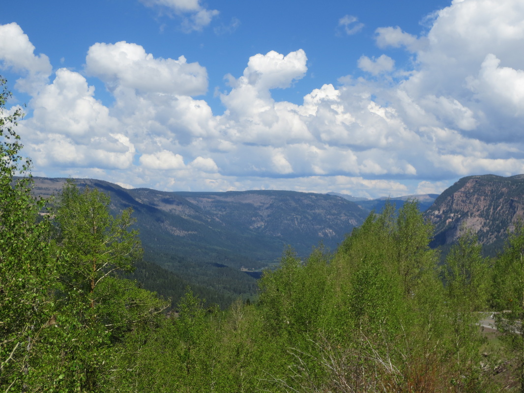
Looking north into upper Conejos River Canyon
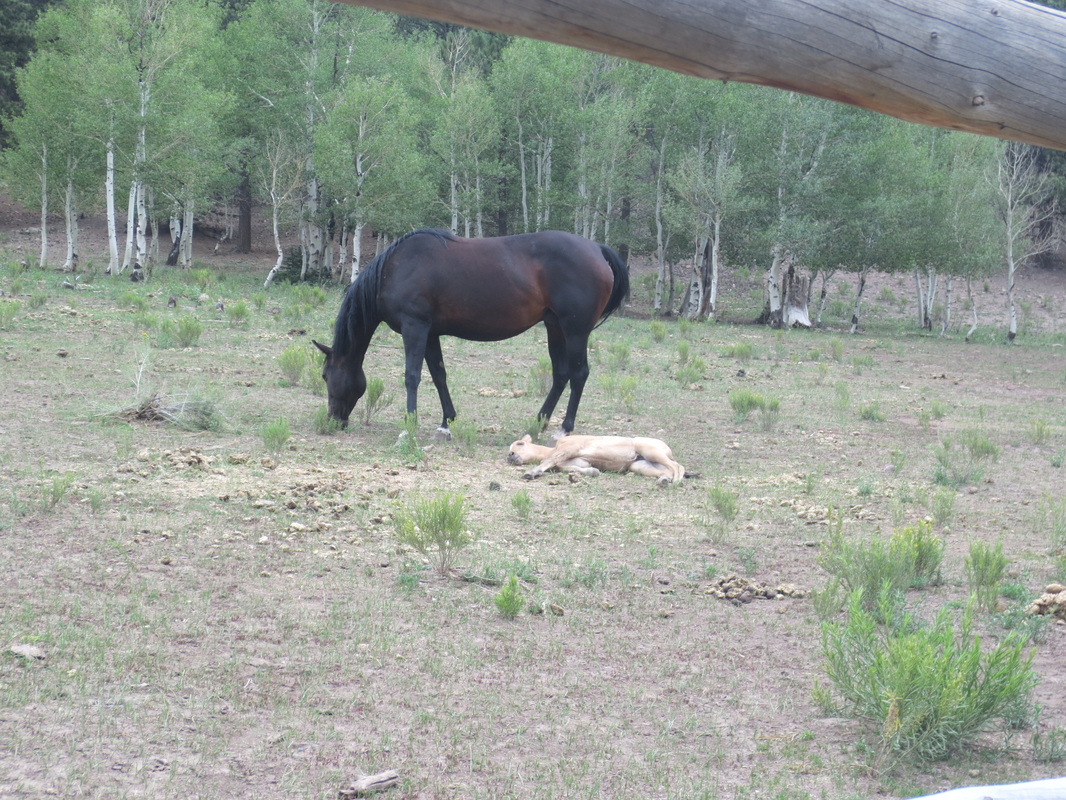
Not just one colt taking a nap.....
|
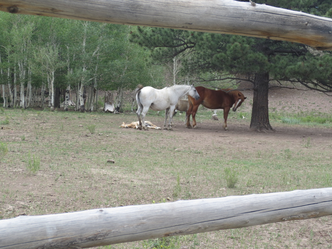
....but two!
|
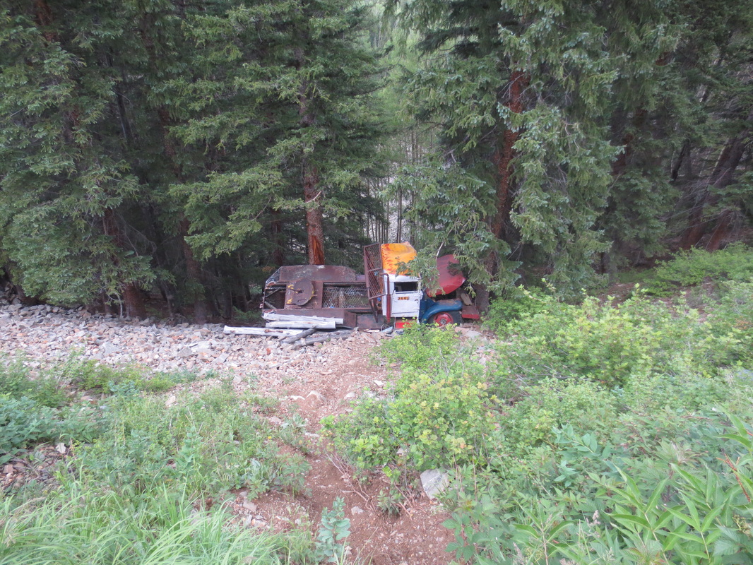
A lesson to not fiddle with the radio while making a turn on a mountain road!
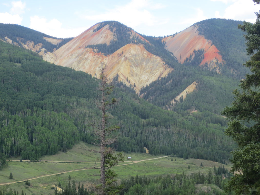
The iron ore and other metals make many of the springs discharging from these mountains naturally acidic. If a nail was left in one of the creeks below it would breakdown and disappear within about 8 months.
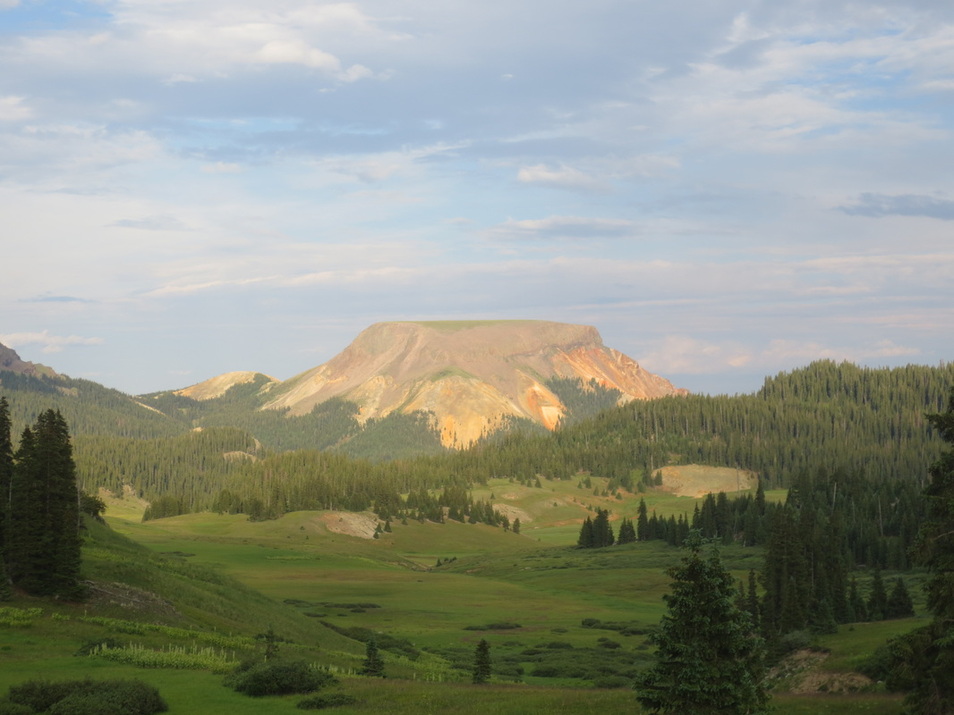
View from near Elwood Pass
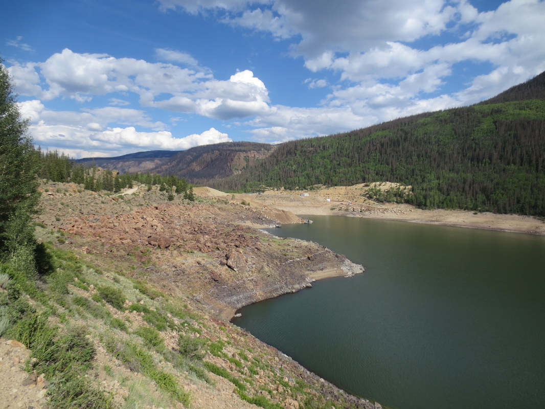
Rio Grande Reservoir
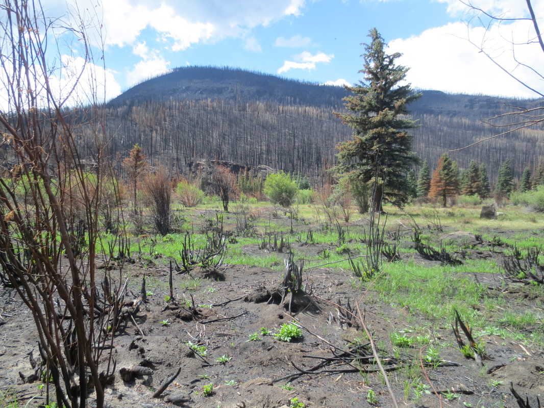
Recent fire spread off of mountain in the background, jumped across the Rio Grande River, and charred parts of this meadow.
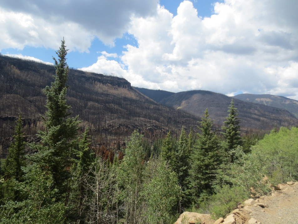
Fire damage on mountains as far as you can see west of the Rio Grande Reservoir Road
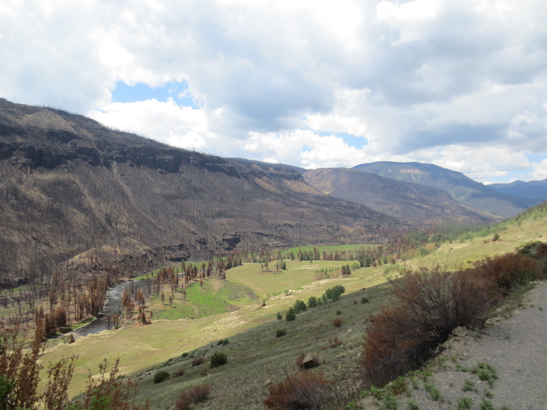
Looks like Rio Grande River was line of defense in this area
Heading up canyon towards Beartown (ruins of a 1890's mining town) about 10 miles southeast of Silverton
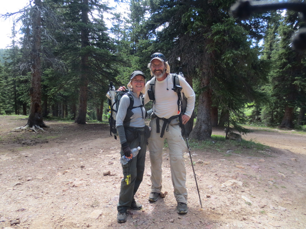
Spot where we finished hiking all of CO - Woo Hoo!
